The Earth Beneath the Sky
PHP, MYSQL, d3.js, JavaScript, jQuery, jQuery UI
JSON, TopoJSON, Shapefiles
My Role in This Project
Position:
Research, Design & Development
Design:
Data Visualization, Taxonomy, Mapping
Data:
Processing and Cleaning: PHP, SQL
Engineering:
Front-end: D3.js, JavaScript, jQuery, jQuery UI, HTML5, CSS
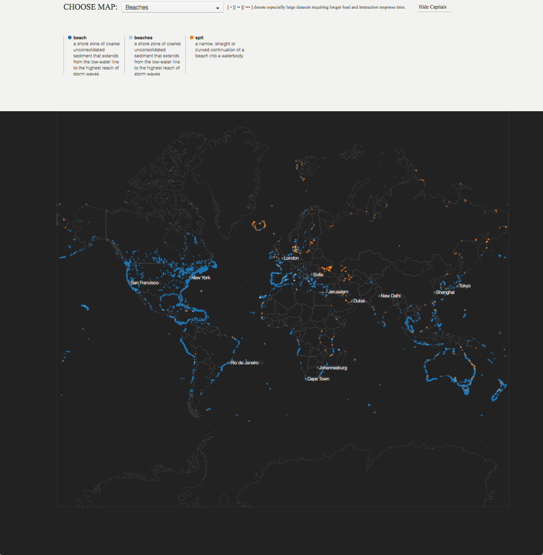
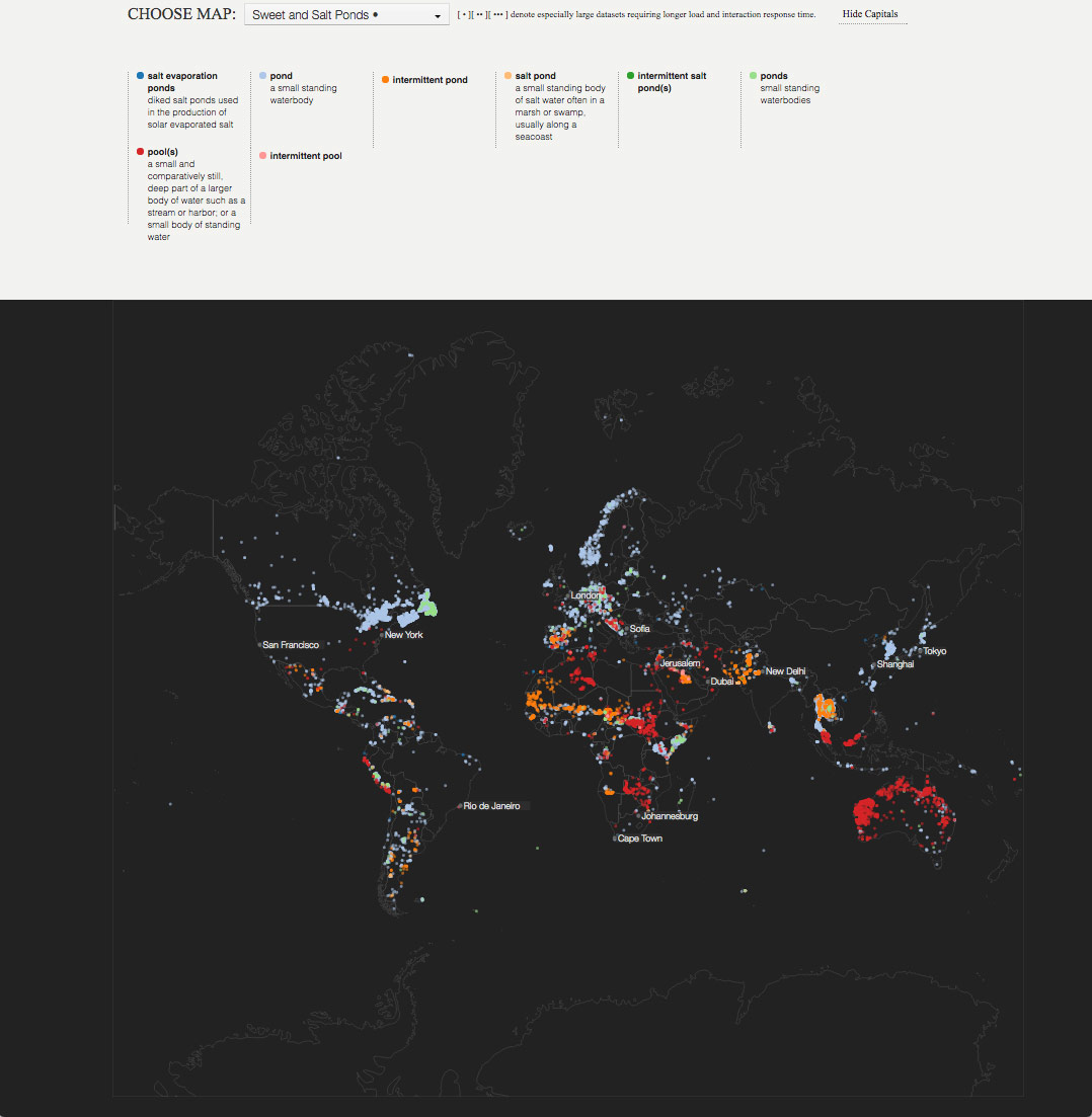
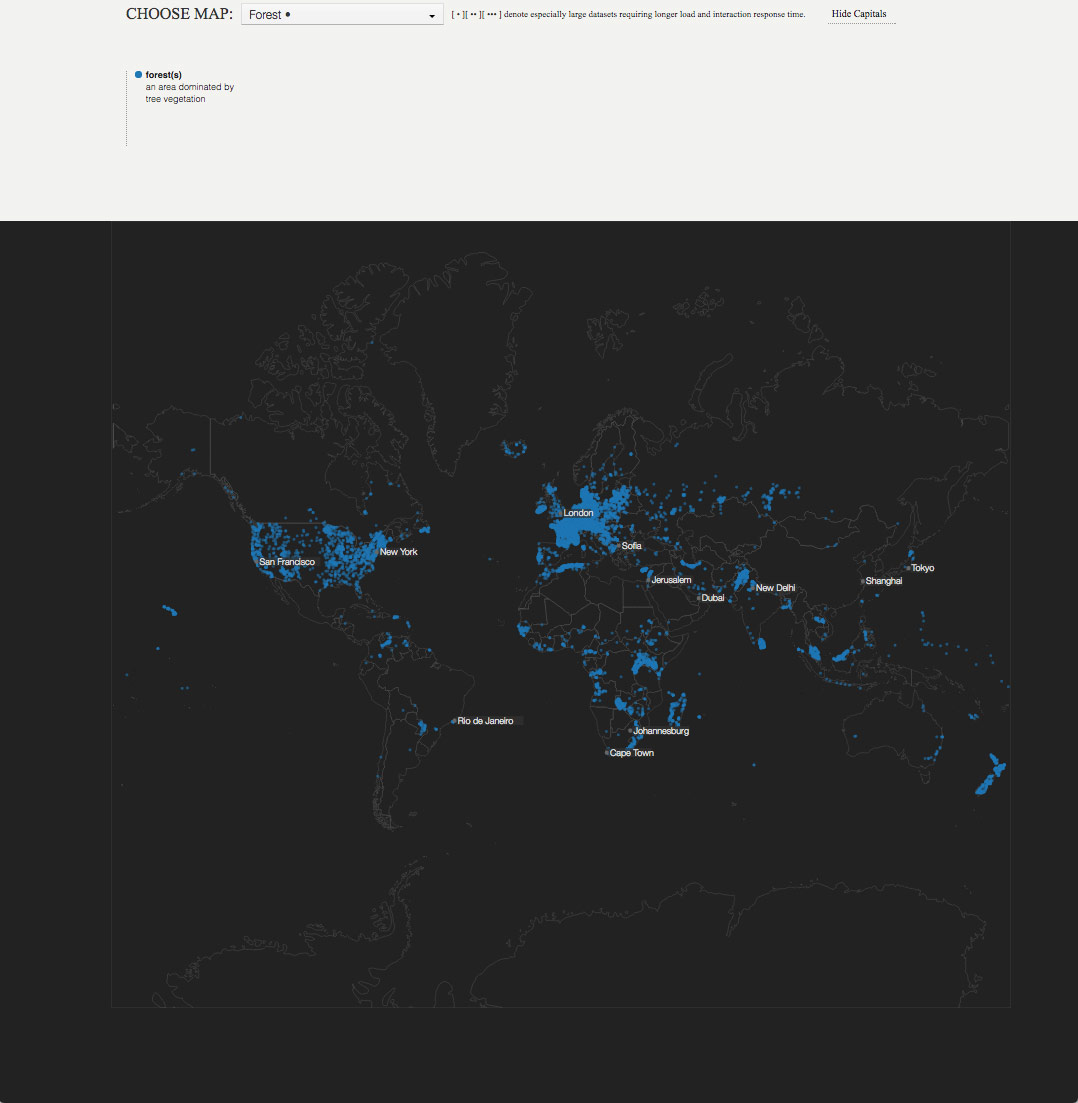
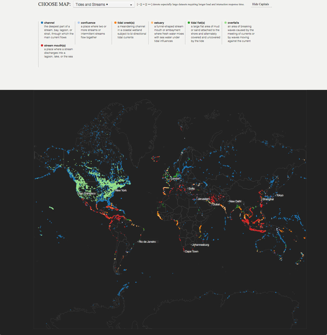
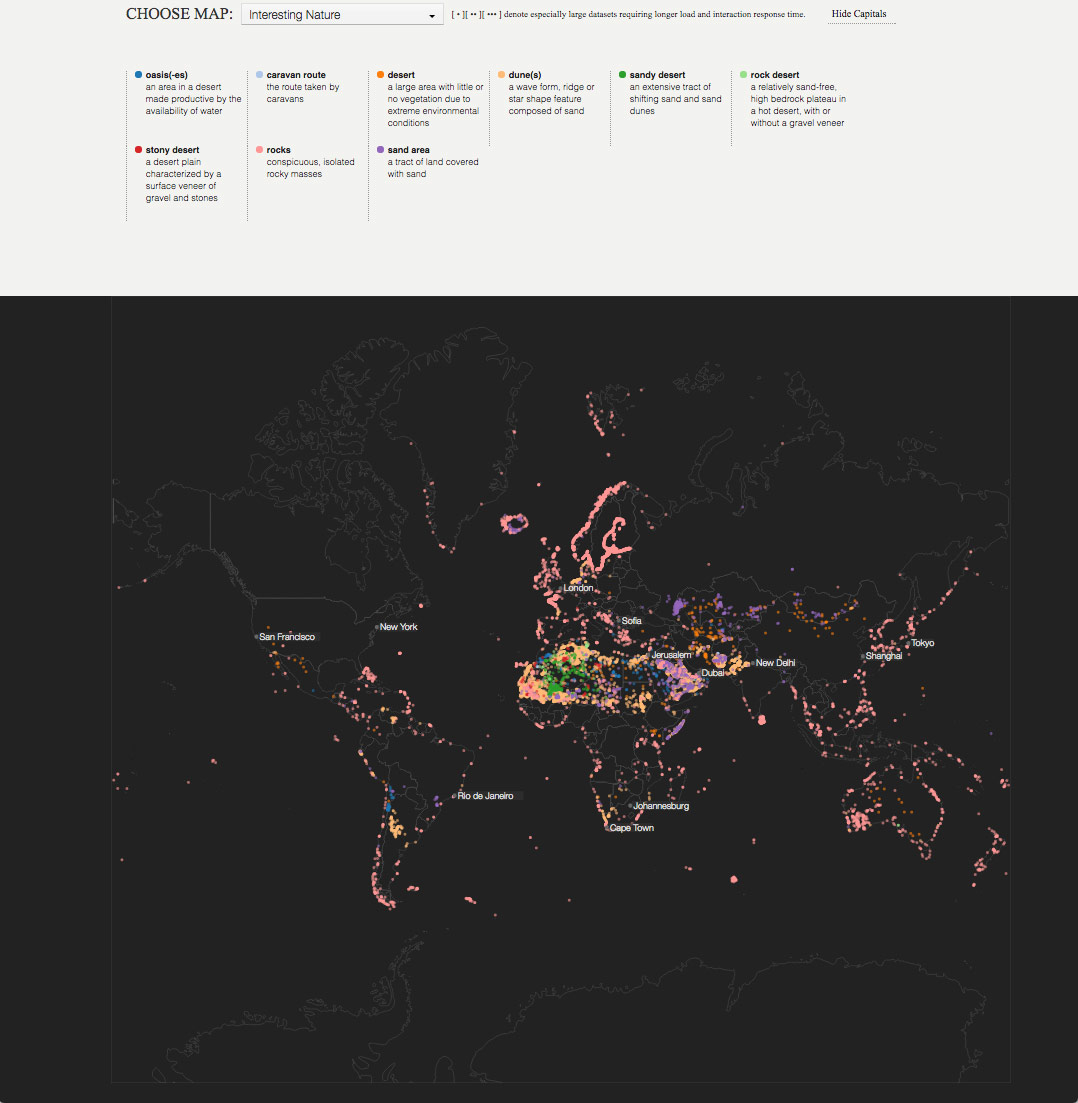
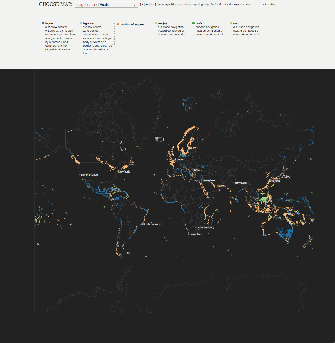
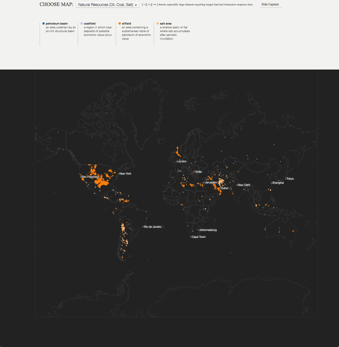
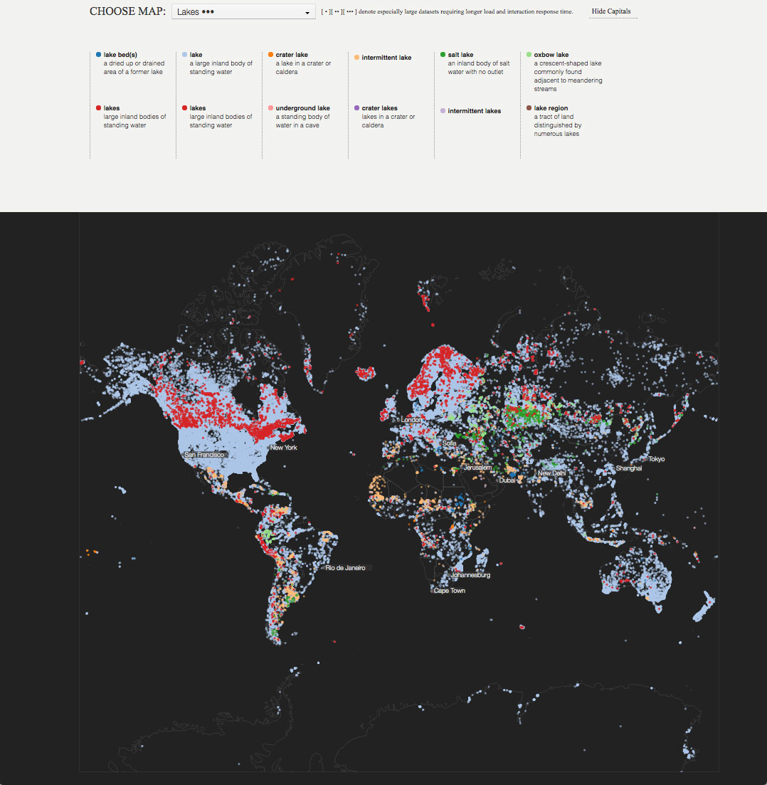
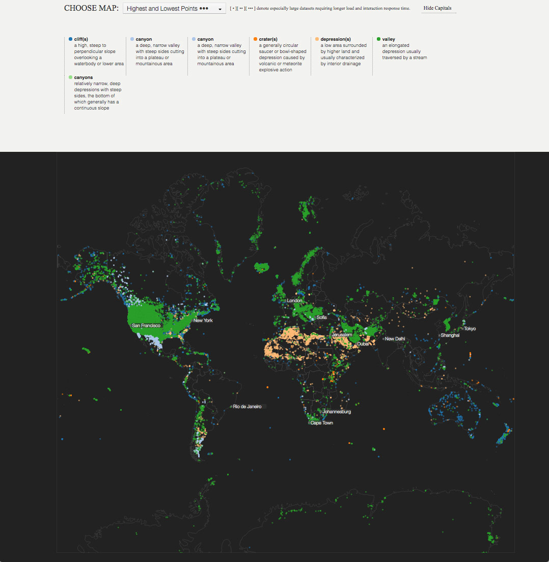
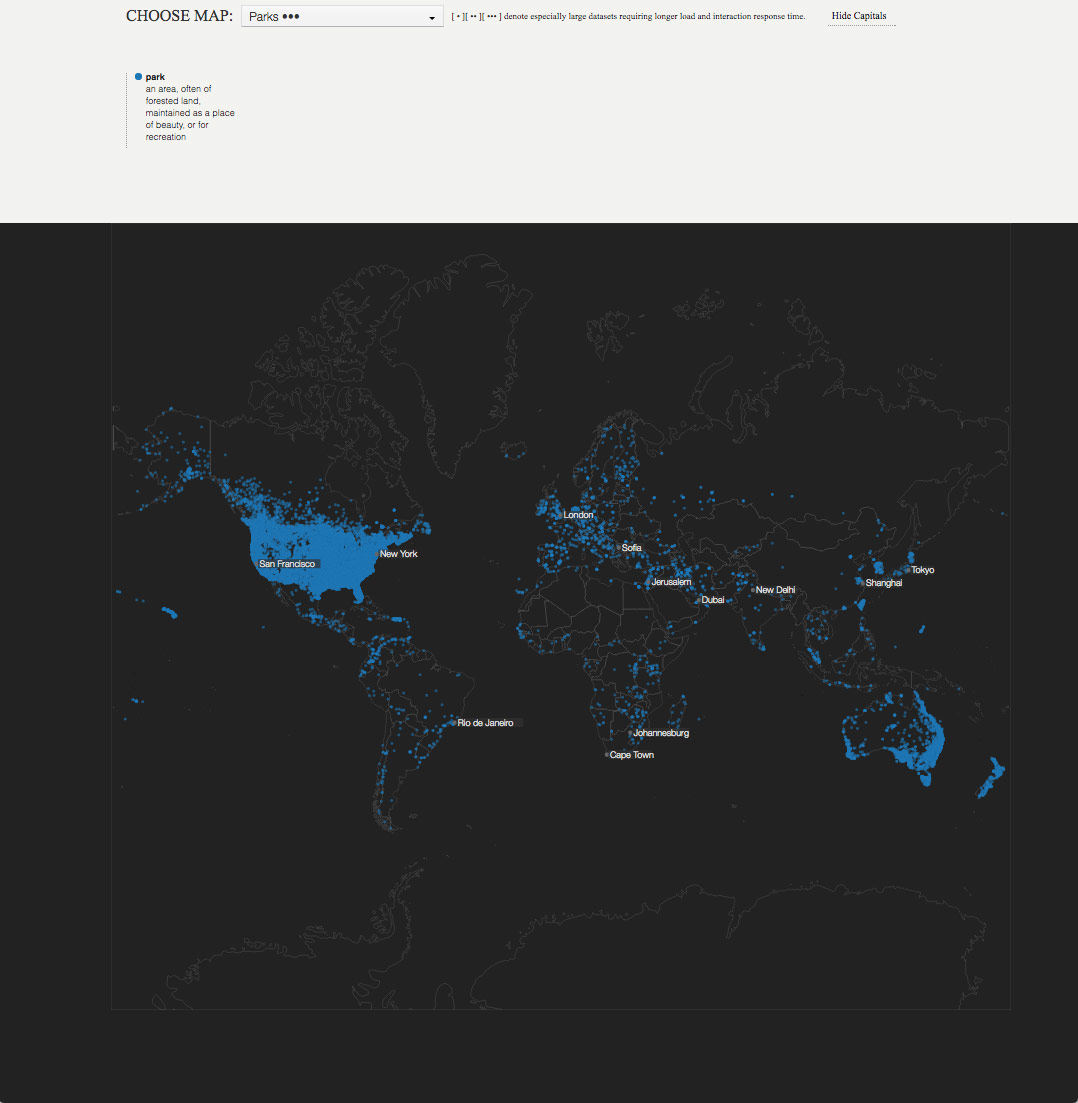
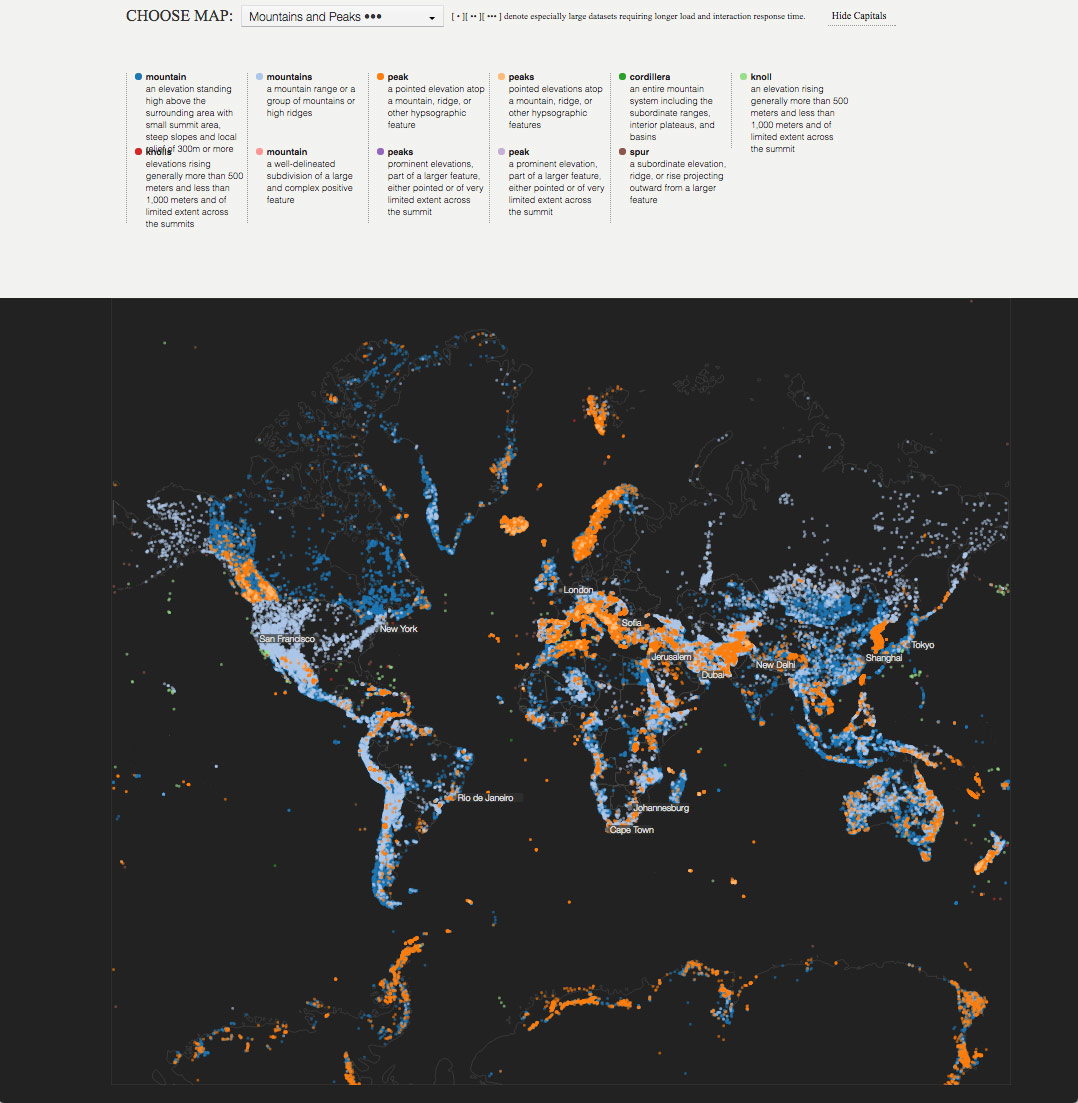
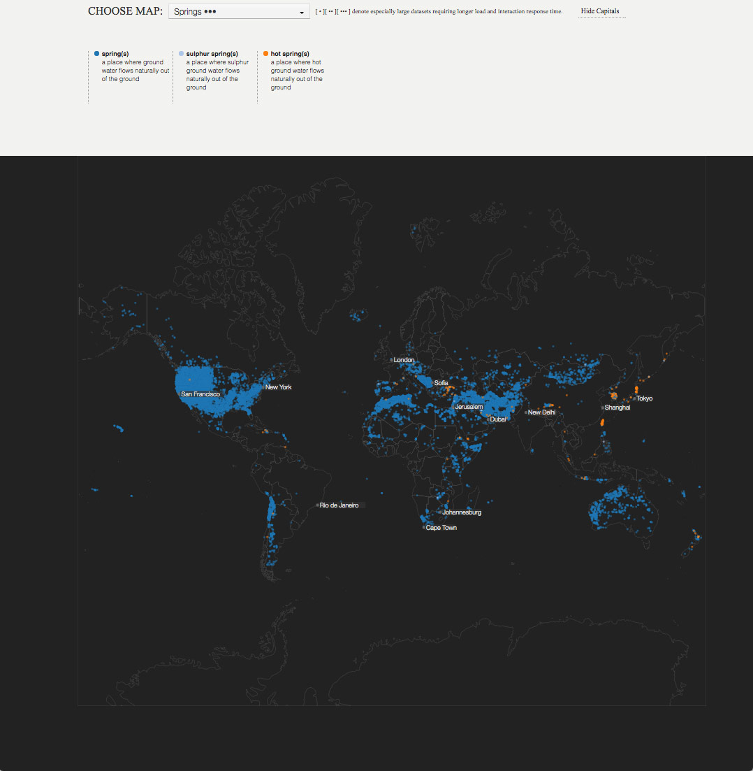
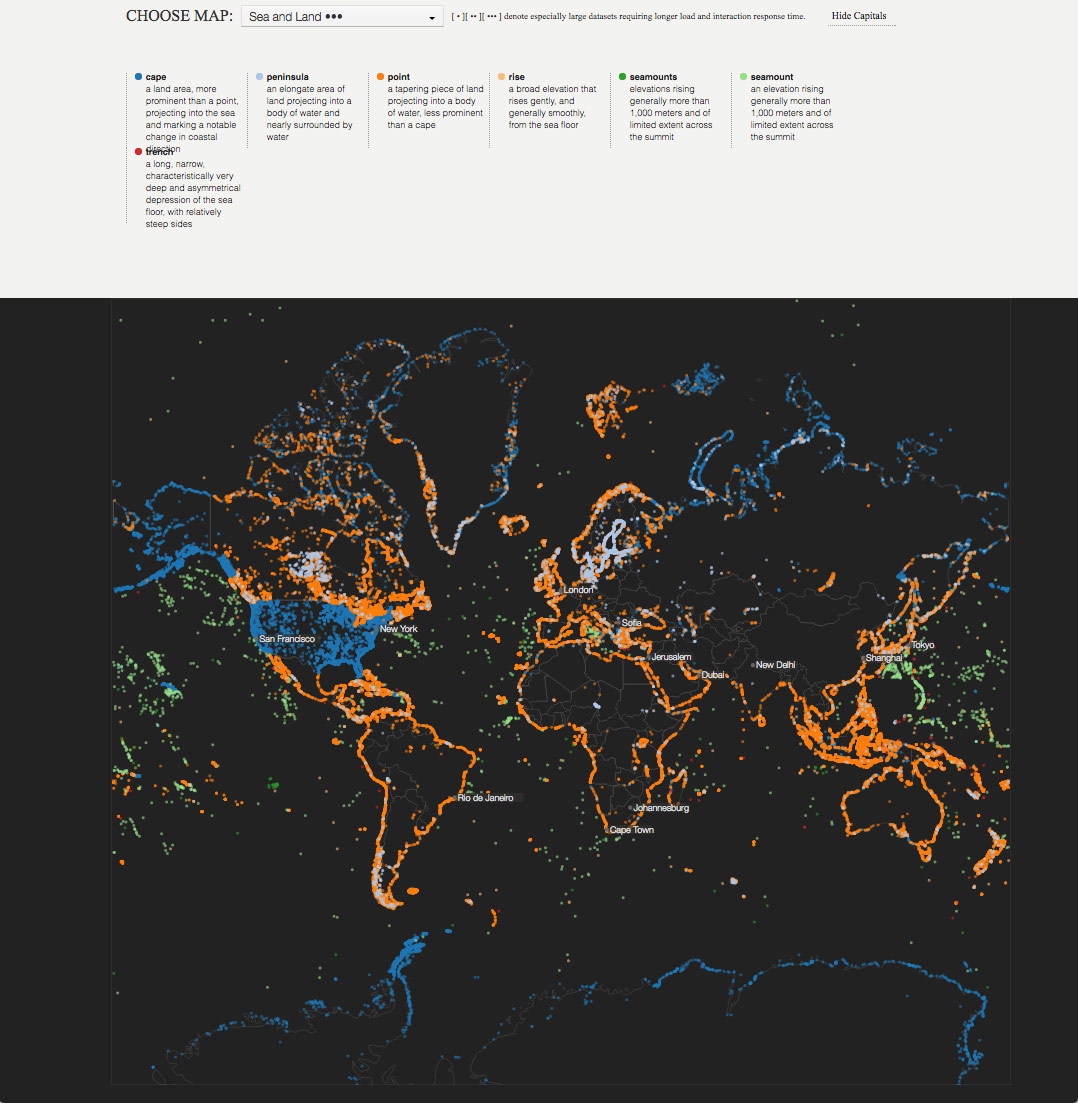
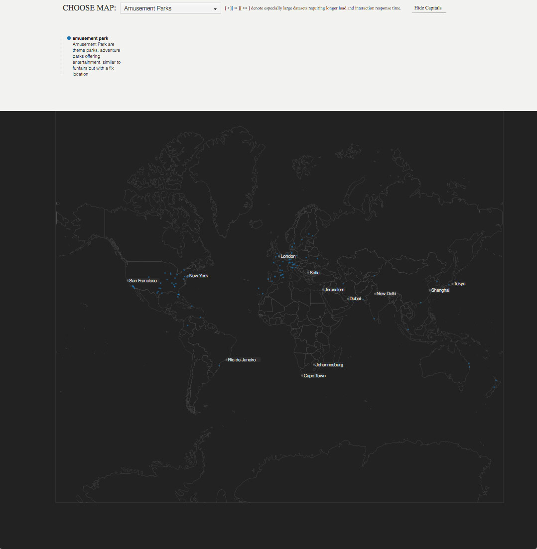
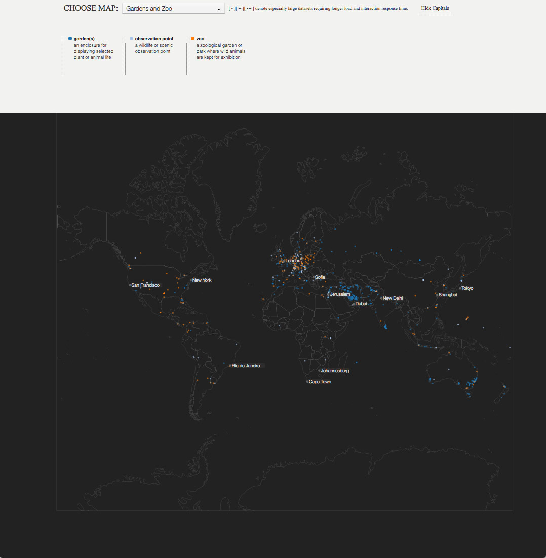
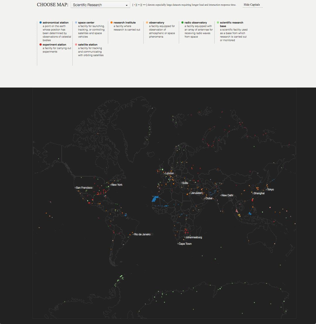
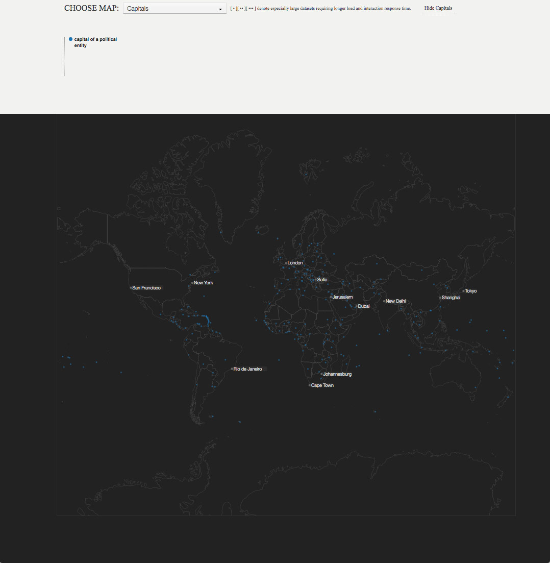
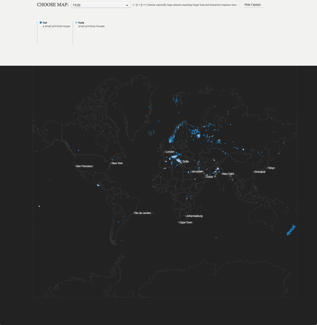
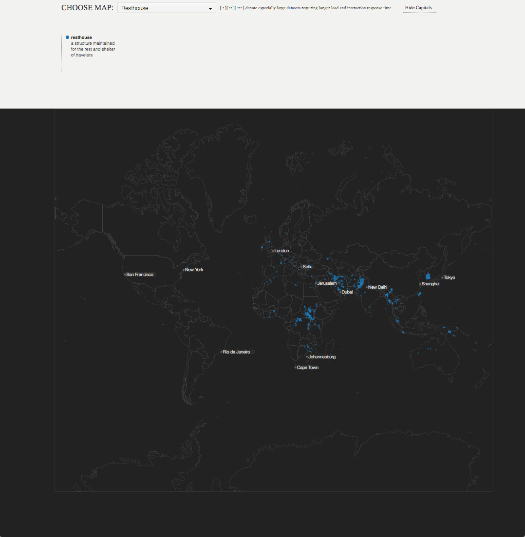
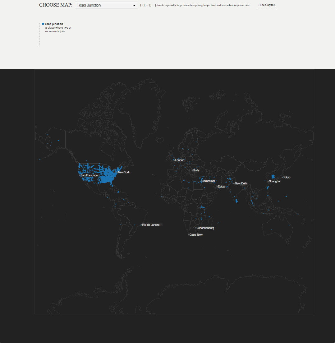
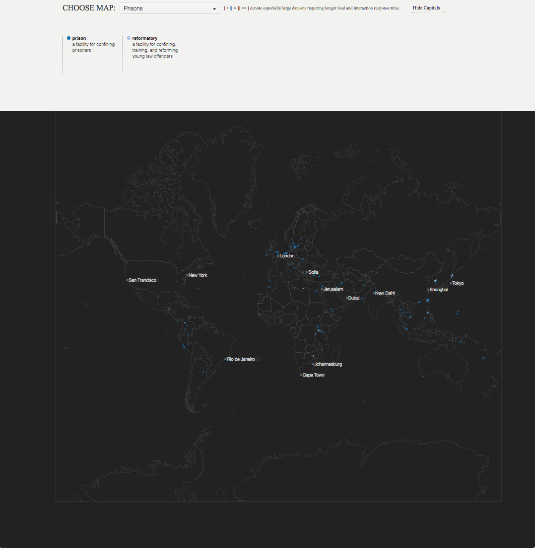
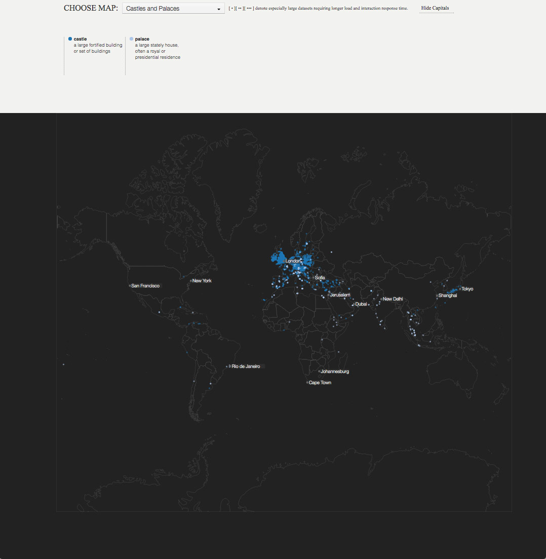
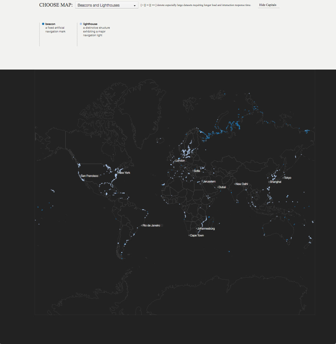
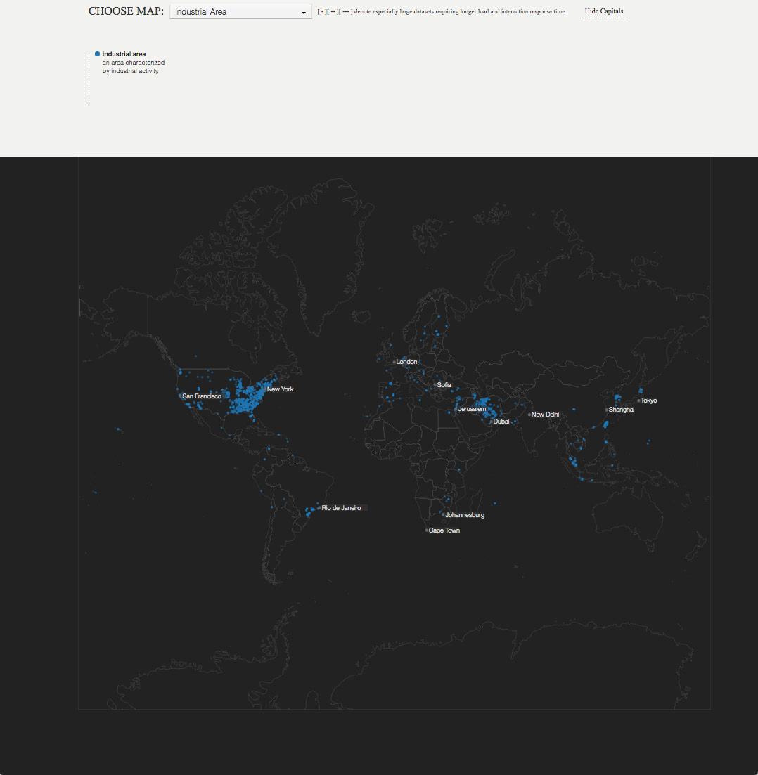
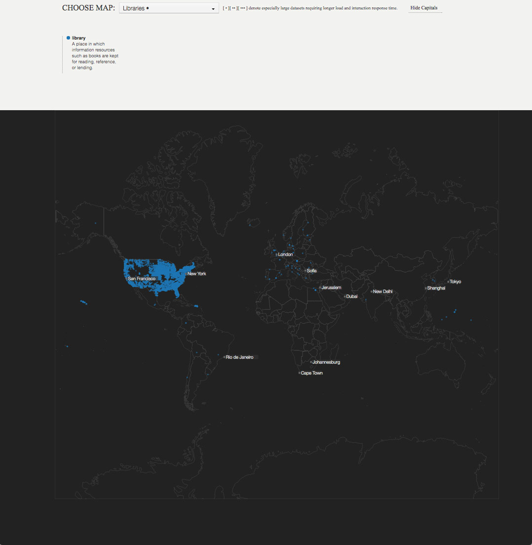
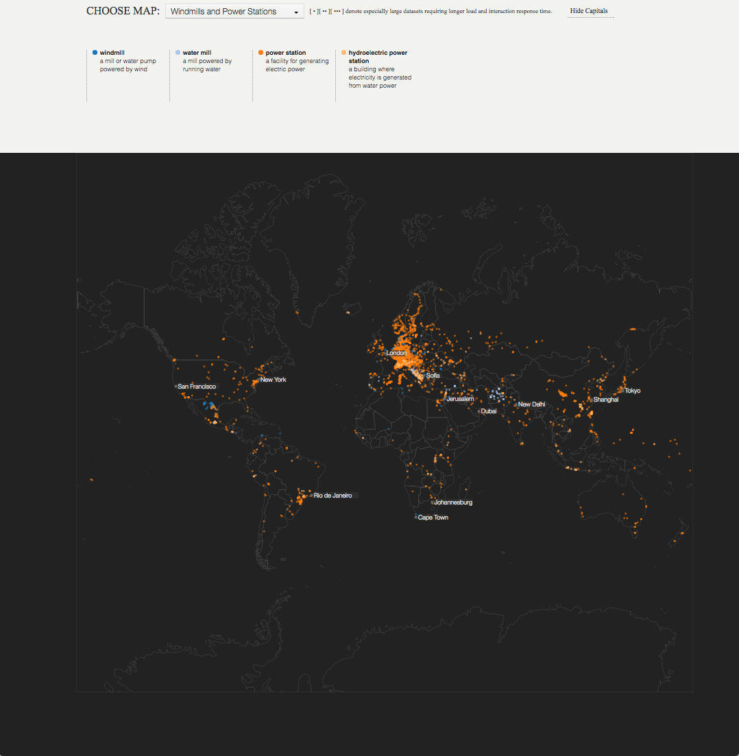
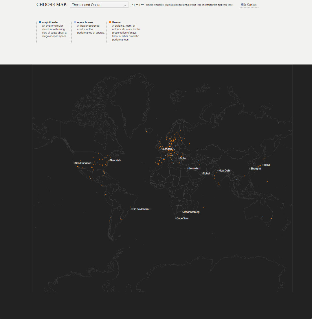
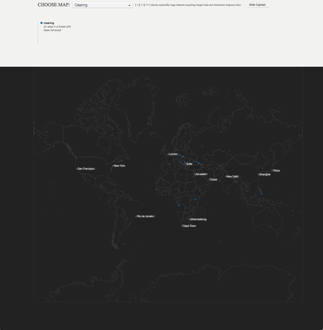
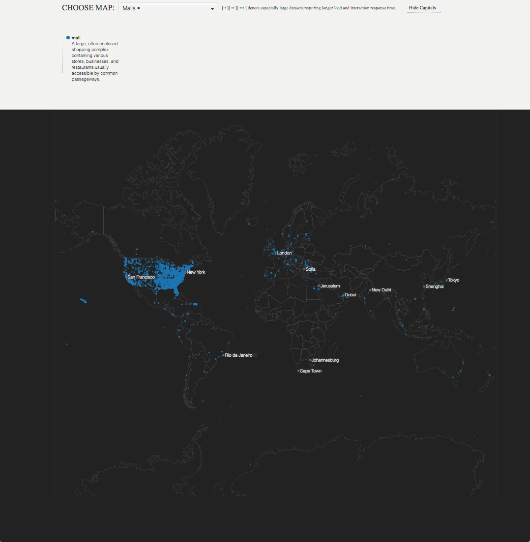
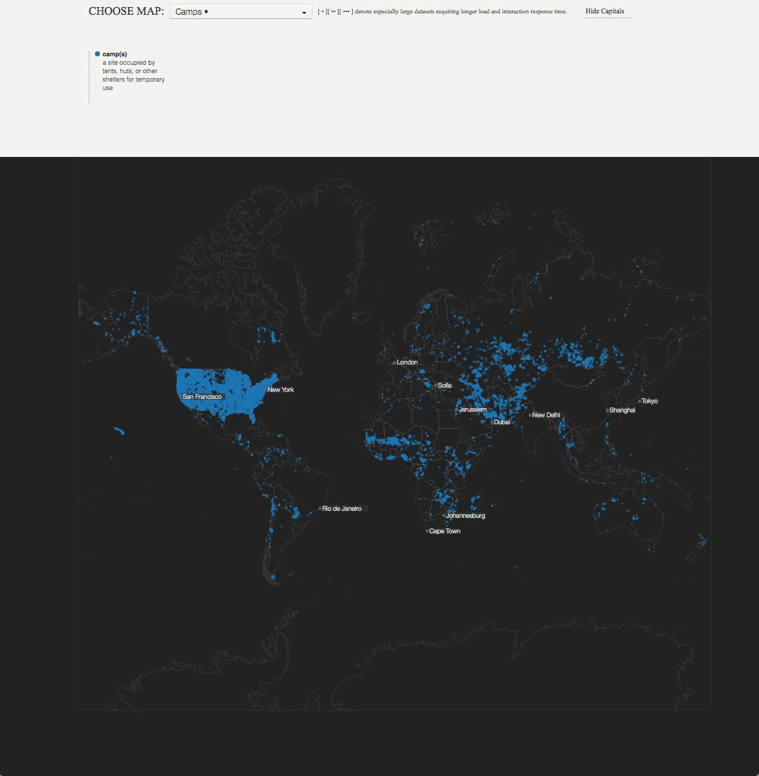
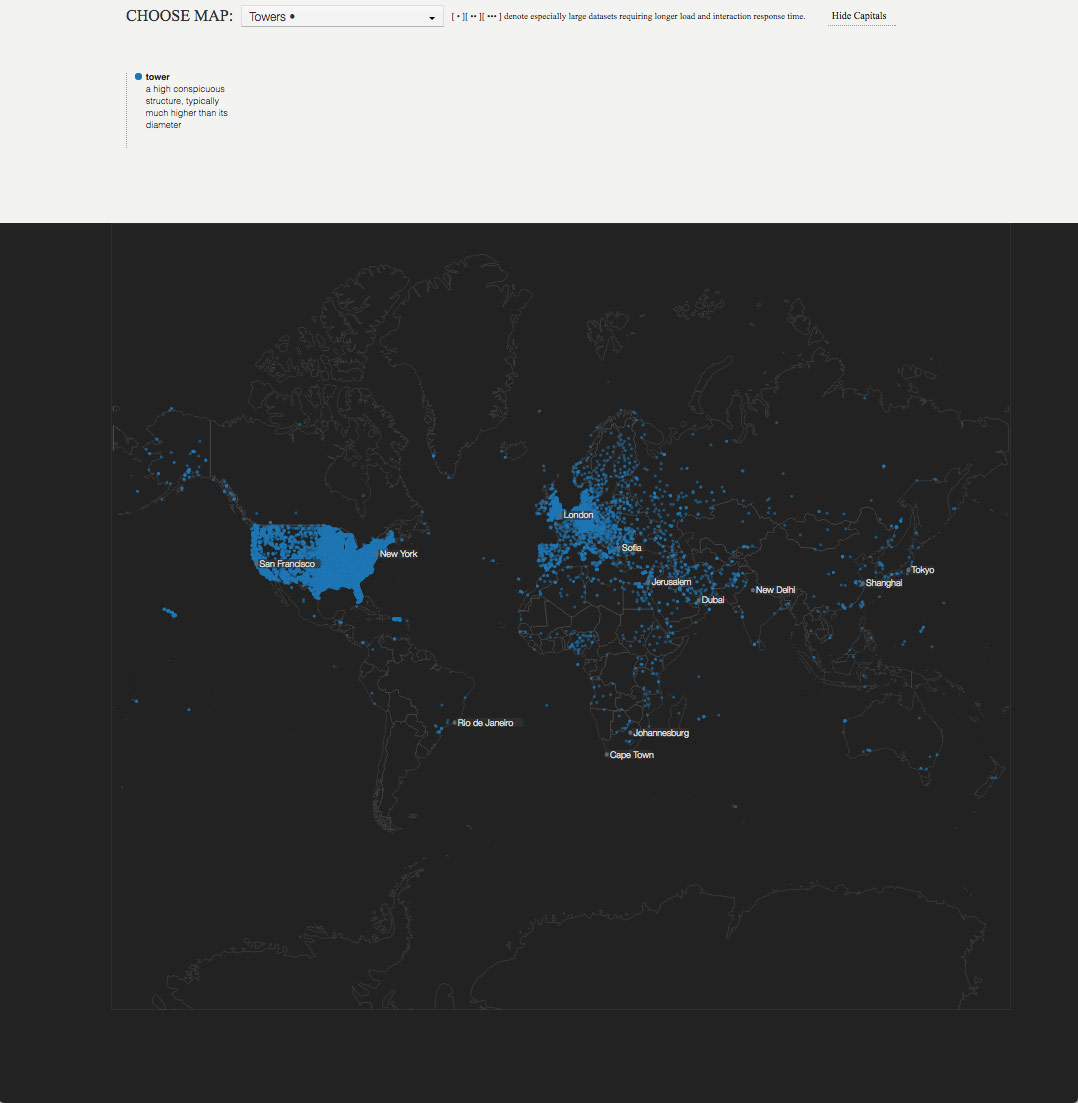
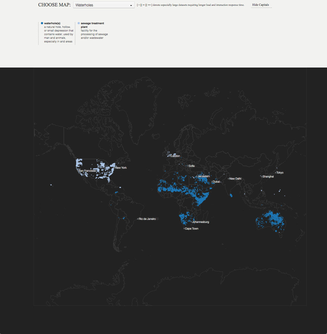
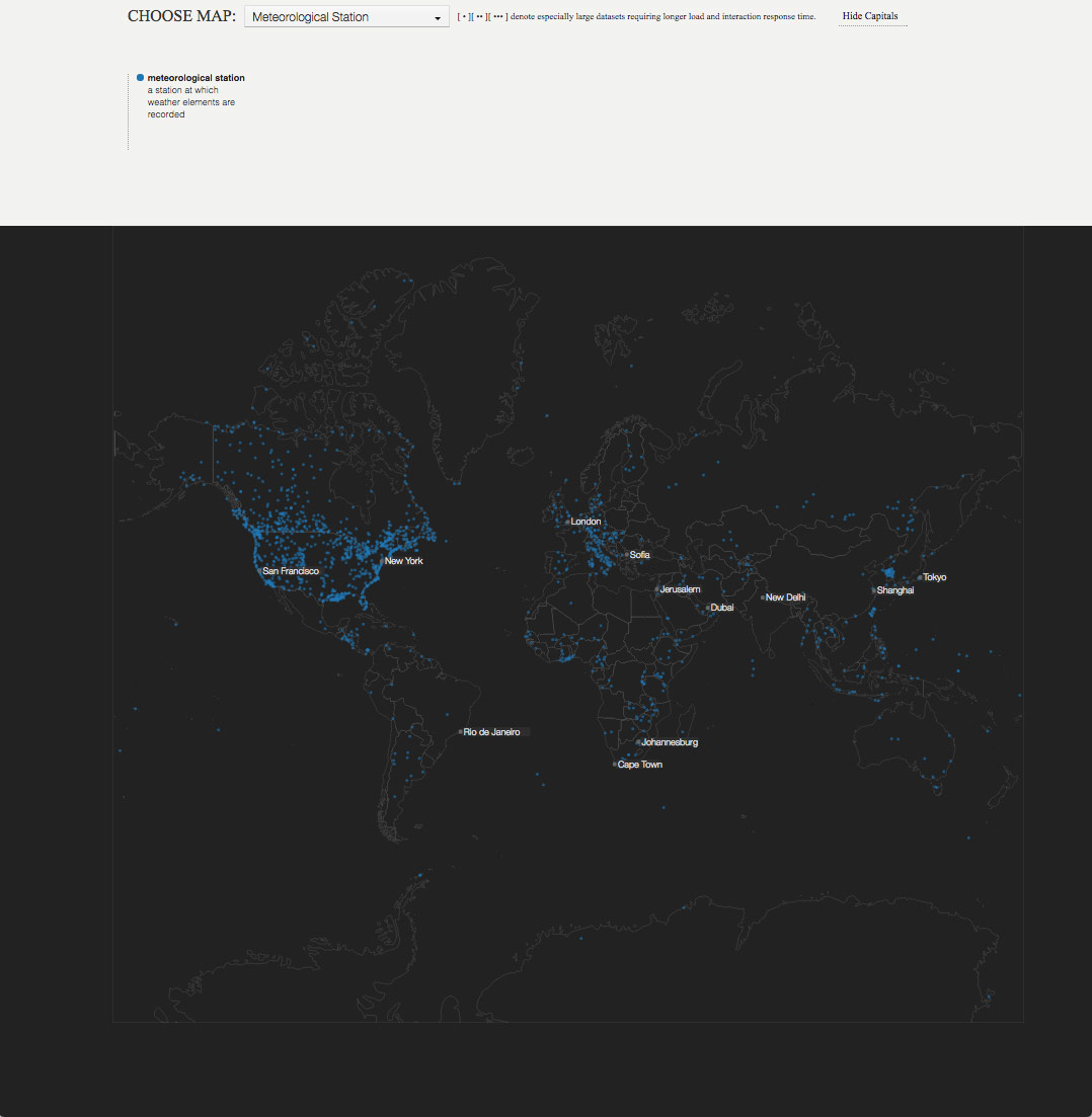
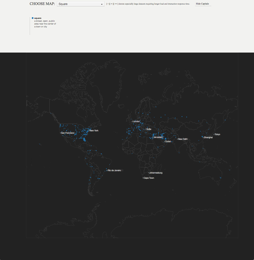
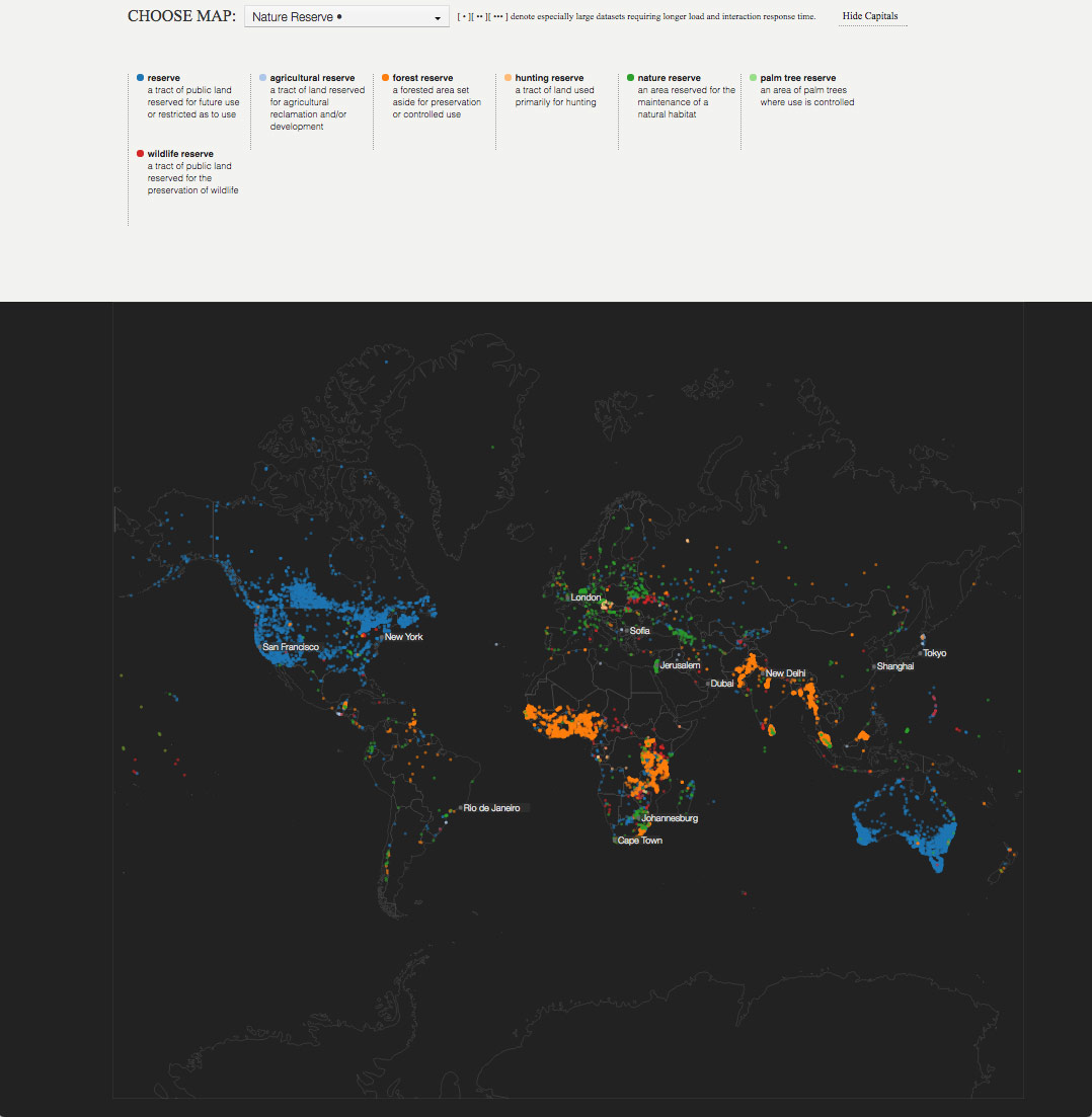
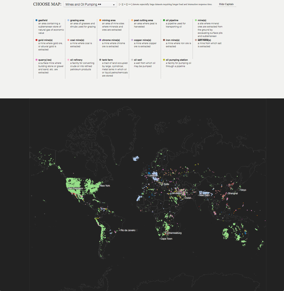
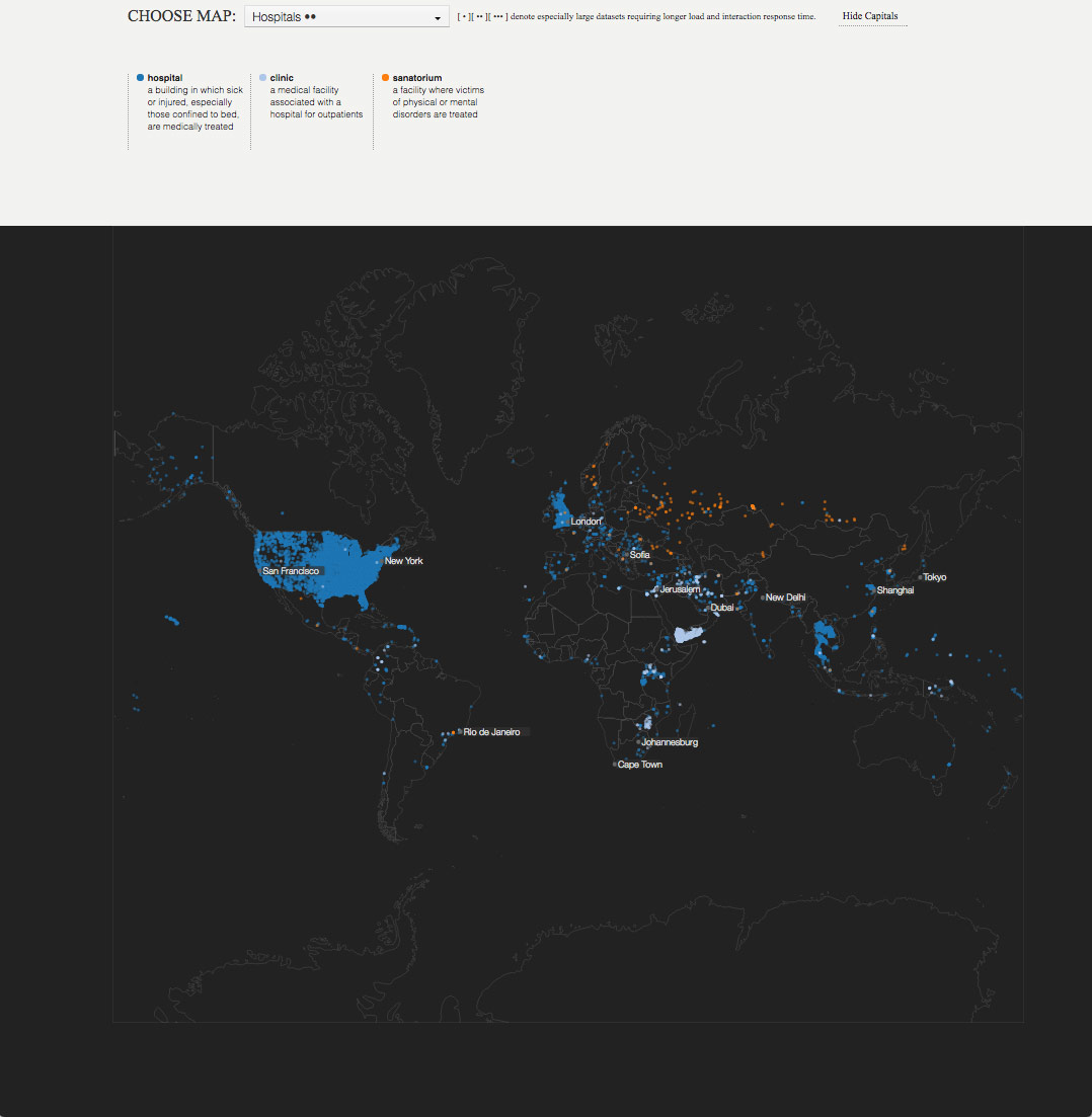
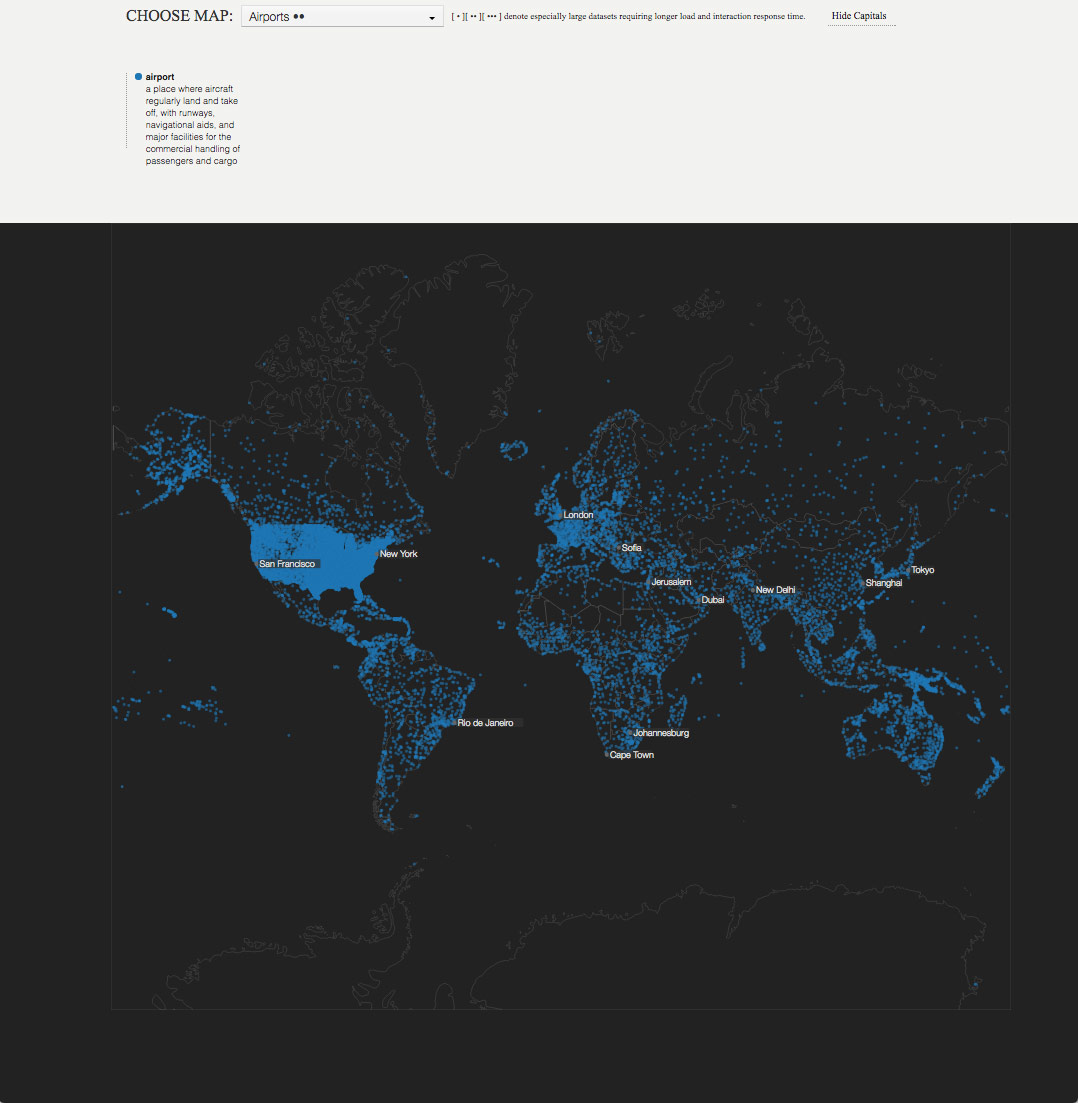
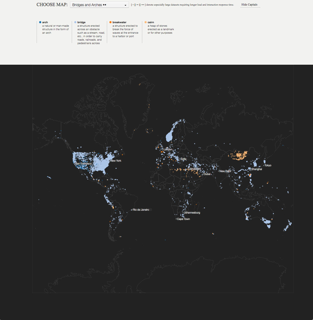
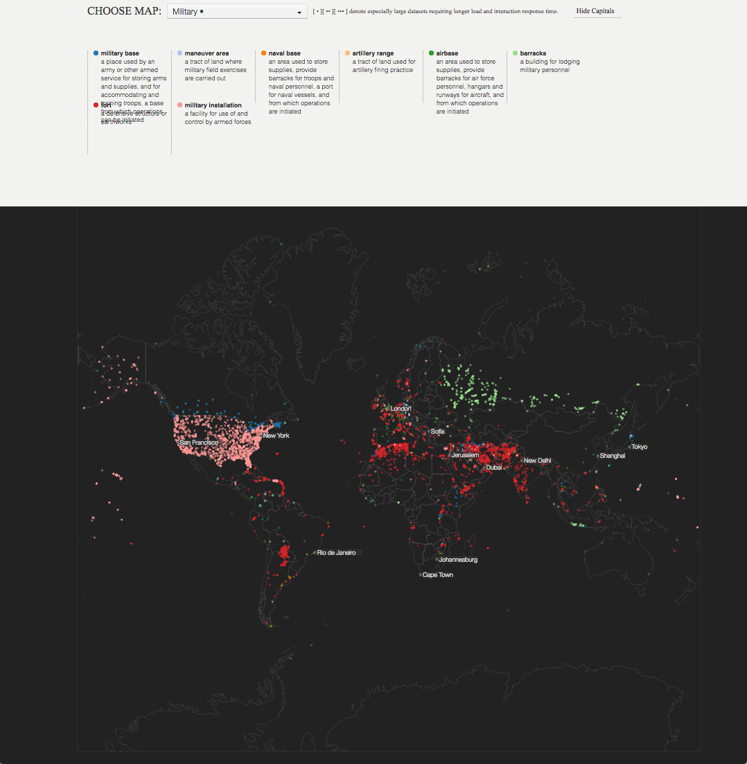
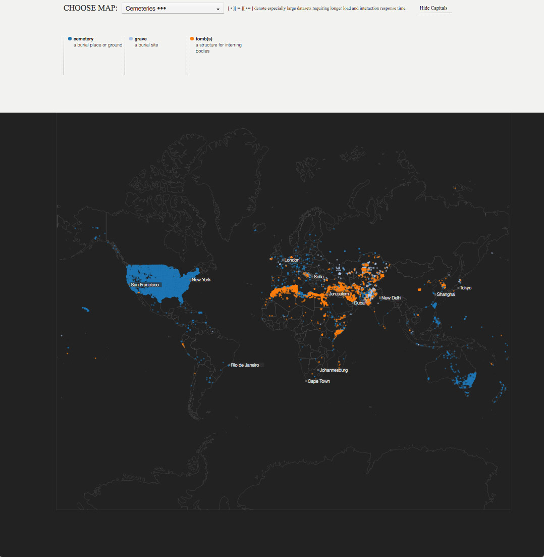
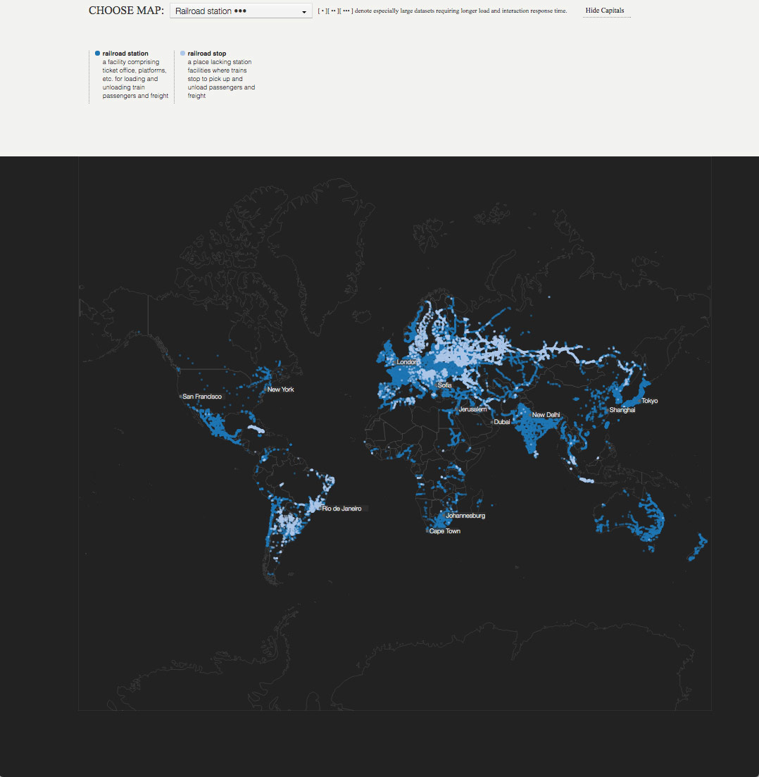
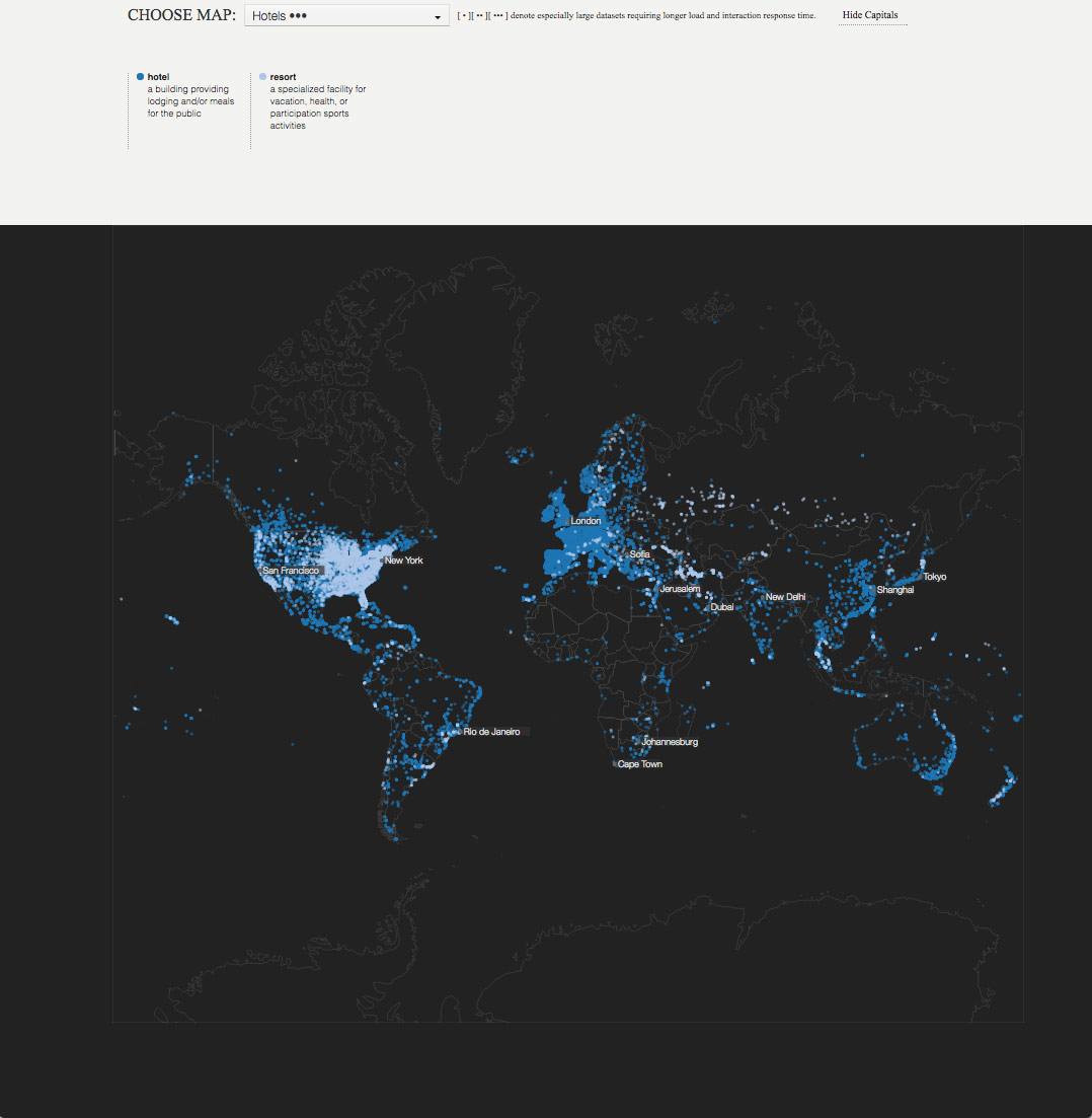
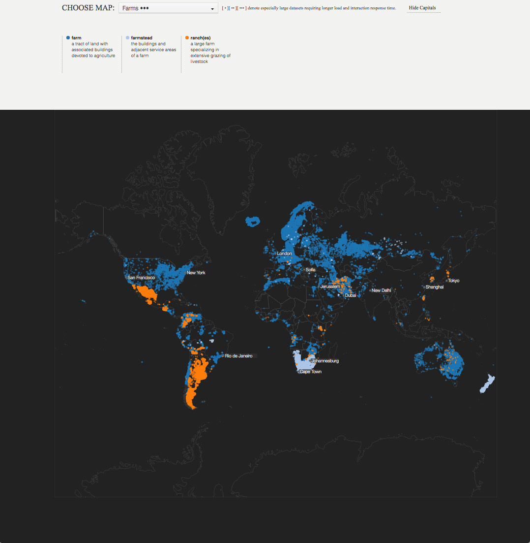
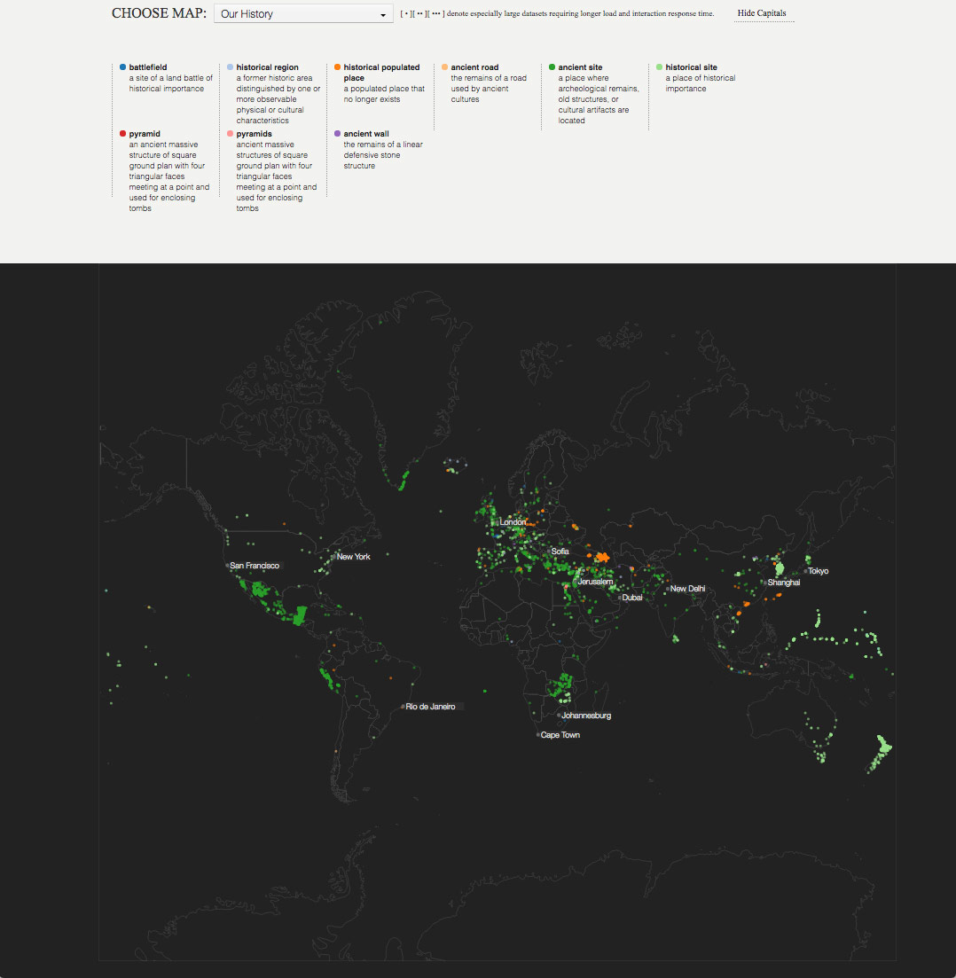
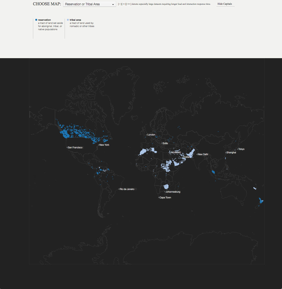
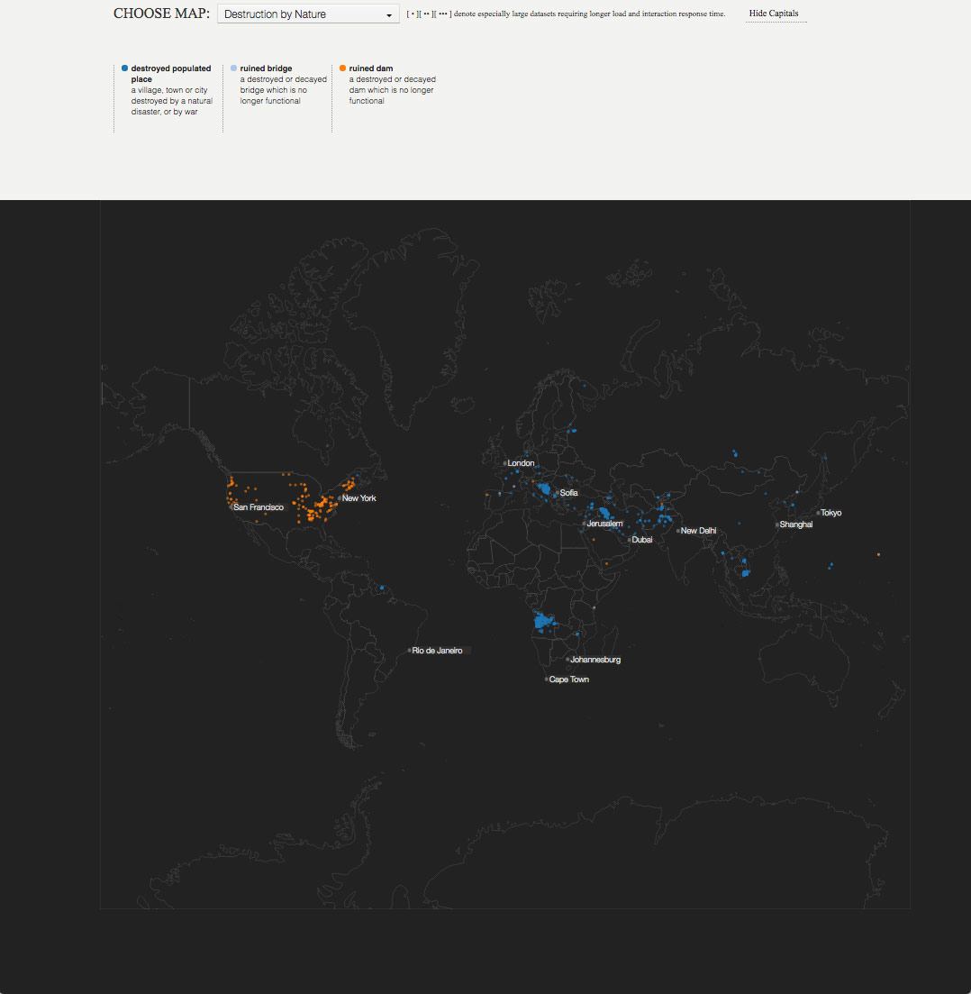
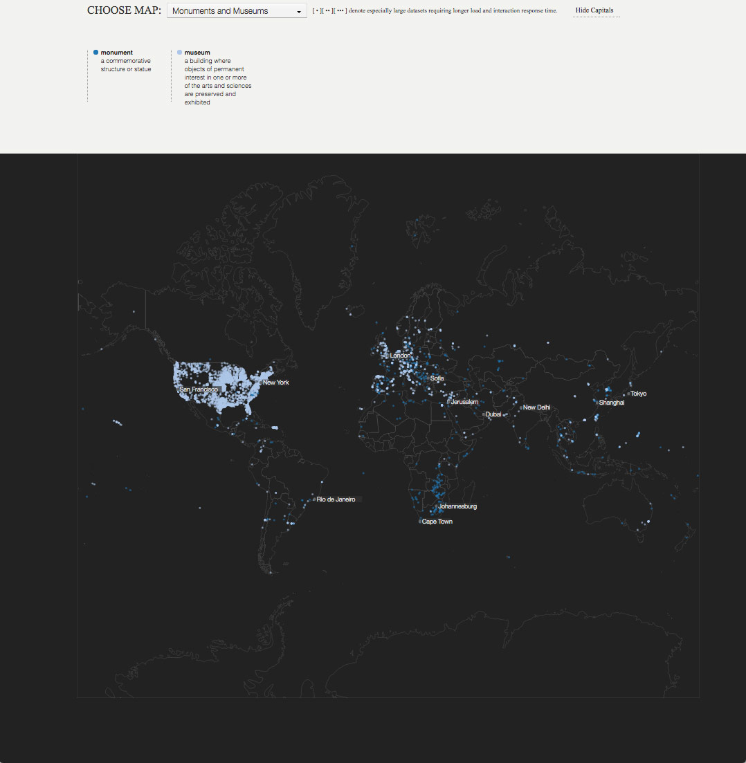
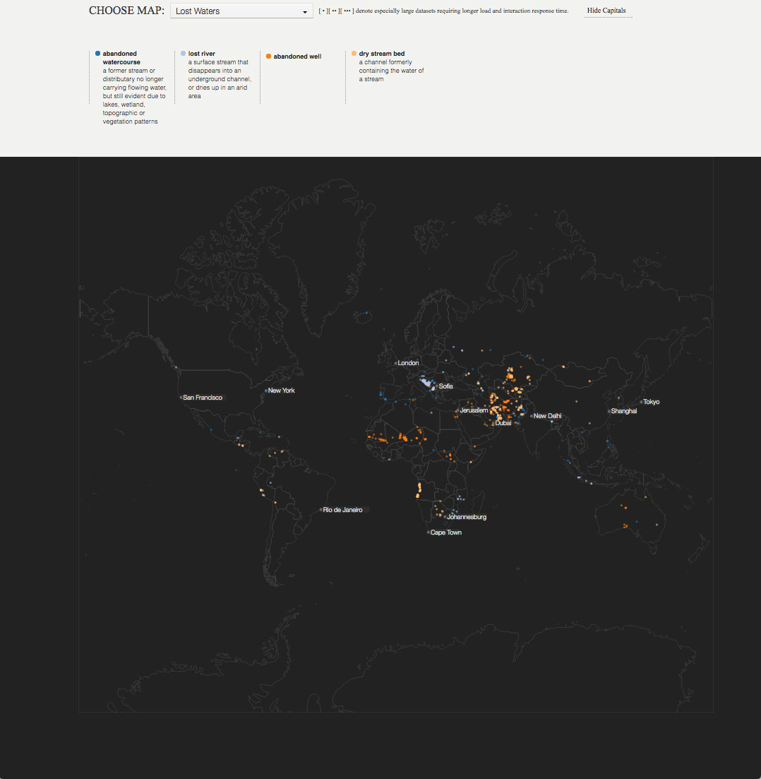
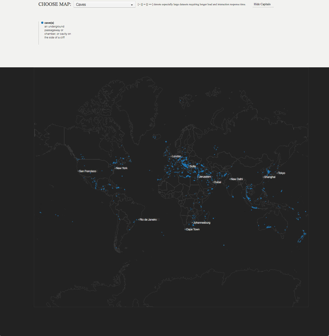
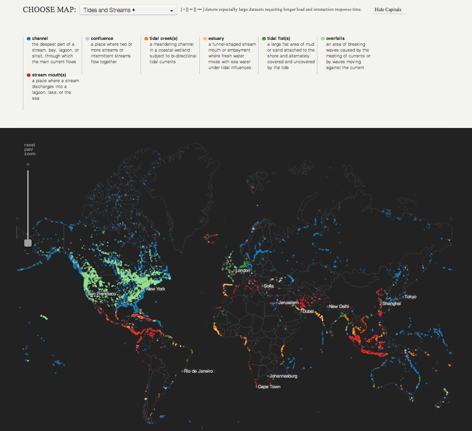
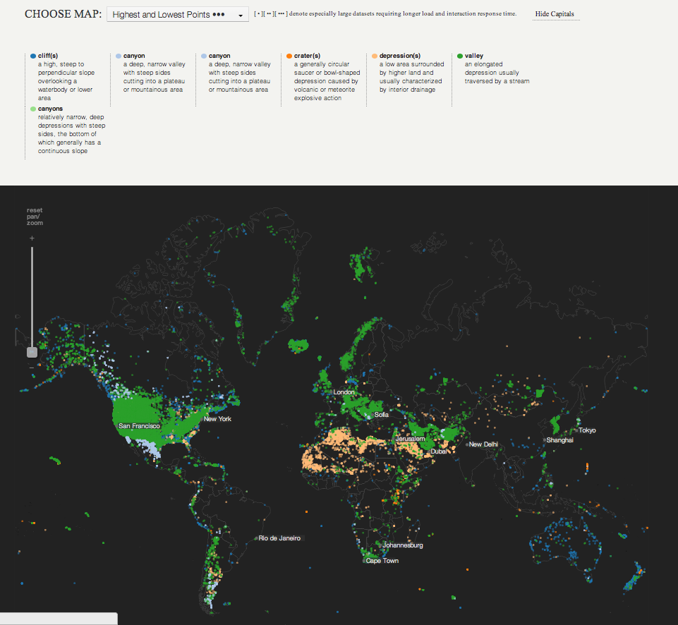
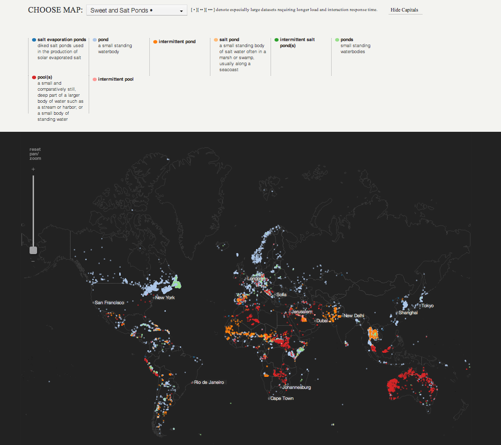
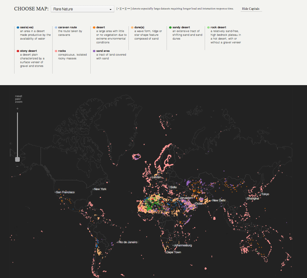
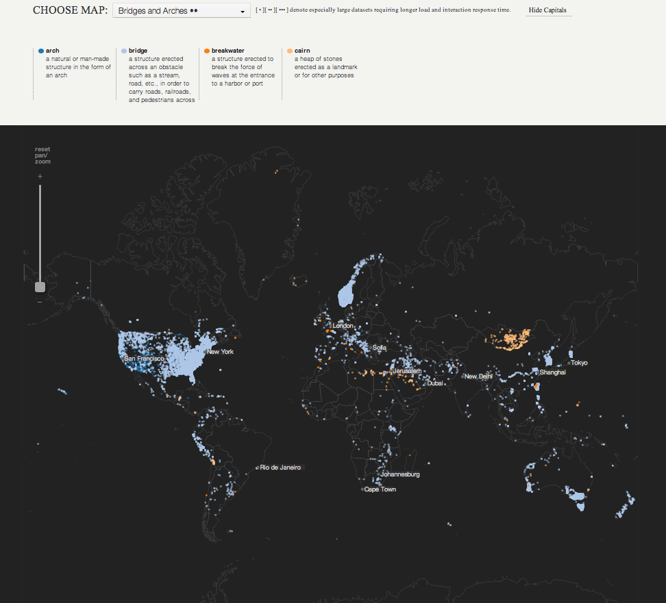
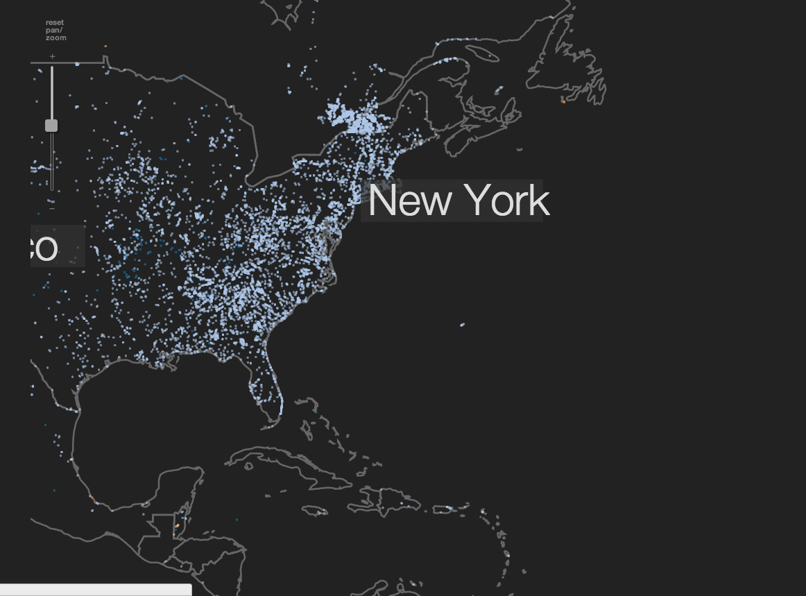
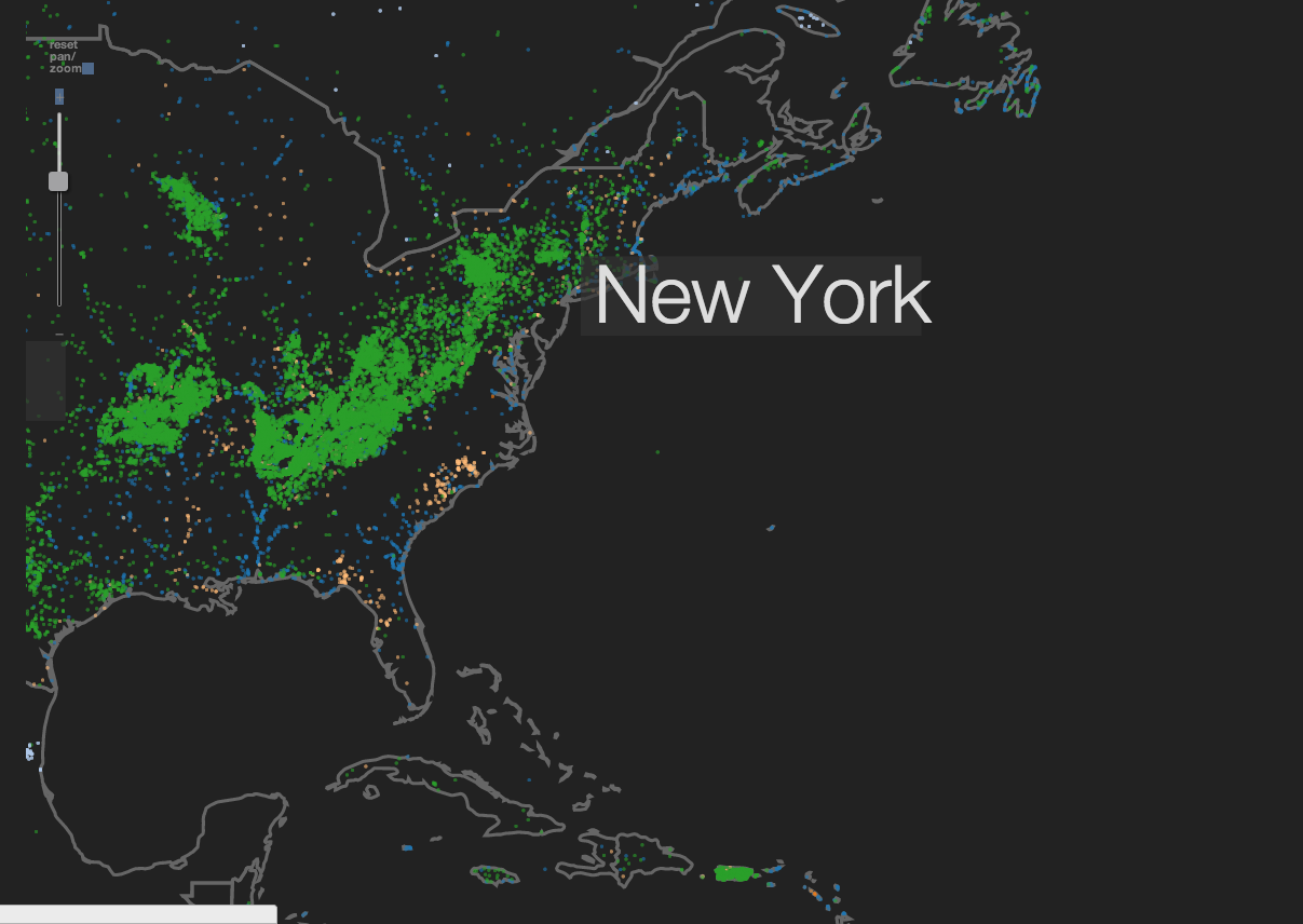
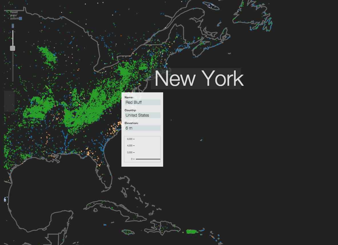
The Earth Beneath the Sky visualizes a geo driven database (geonames) which contains about 8 million data points at the moment. The data are distributed among 645 different feature codes (categories) ranging from natural phenomena such as glaciers, mountains, deserts to human altered geo spaces such as cities, mines, hospitals, malls, etc. Even though the dataset is incomplete, it is still effectively describing the Earth, allowing us to explore distant places and discover interesting connections at a glance.
After processing the entire database with PHP and SQL, I narrowed it down to a taxonomy of about fifty datasets visualizing a feature or thematically related features. You can choose a map in one of three categories: natural occurring geo spaces, man made geo spaces, historical geo spaces which no longer exist or are related to preserving historical artifacts.
This visualization is an inititial experiment with larger datasets, canvas, and svg. The taxonomy and programming logic would be changing as the project advances. Naturally the data necessary to describe phenomena such as all mountains on the planet are quite big, and despite multiple rounds of optimization some of the maps still require substantial amount of time to load. To help you distinguish these datasets, they are assigned a system [ • - some time, •• - more time, ••• - expect significant delays] indicating the relative load time necessary.The next step would be to implement the maps in canvas rather than svg for improved performance.

 Loading Data...
Geonames.org Map shapefile:
Natural Earth